
Know when you’ll get there
/When we’re on the trail, most people respond to our greetings with a polite hello. But there is always someone that asks, “How much farther?” It’s the big question on the trail. Now Cairn can tell you. It won’t use up your battery, it’s instantaneous and works offline. Here’s a quick (like, 20 second) lay of the land:
See if your trail is there
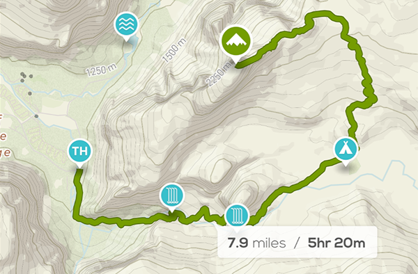
Search for your destination in the app. We’ve significantly improved the way search works, so your destination should come up right away. Your trail will be outlined in green. If your trail’s not there, shoot us an email and we’ll add it.
Download the map

This step isn’t strictly necessary if you know you’ll have strong cell coverage. But we always download our maps beforehand because it saves battery, time and data costs. The whole thing is a two-tap process, because Cairn now knows just what part of the map to download.
Get out on the trail and bring up the app
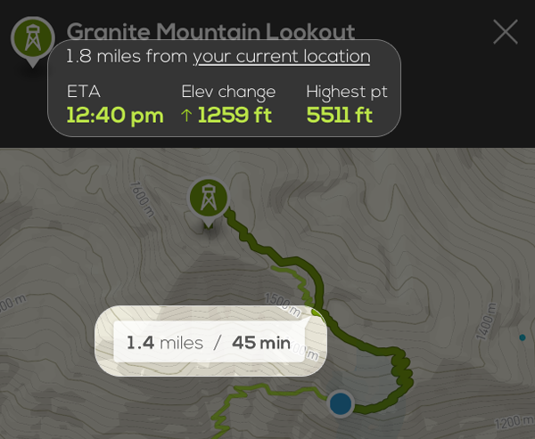
You’ll automatically see all your stats; when you’ll get there, elevation left to climb (or descend), even the highest point along your route. Having this info at your fingertips will make you feel like a hiking superhero know-it-all.